

Old School Open Ocean Racing
 09-21-2018, 09:52 AM
#1
Registered
Thread Starter
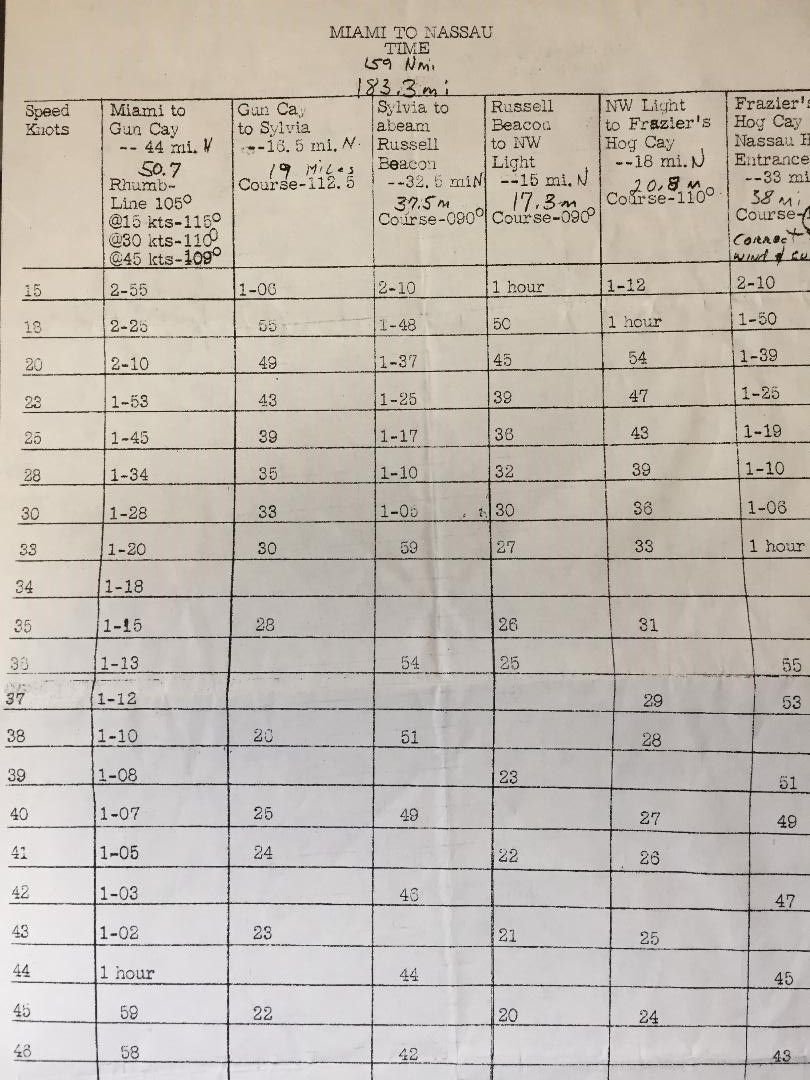
When we talk about real open ocean racing, we are talking about races like the old Miami to Nassau race. No GPS, no Loran, just some compasses with thick oil in them and some paper charts, that you could work with to make some decisions on how to get there.
Each column is point to point from one place to another. Second column is from the start in Miami, to the first checkpoint at Gun Cay. Distance of 44 nautical miles. The (Direct Line) Rhumb line, is 105 degrees and the variance of where you should run is based on your actual speed over the bottom vs the northern flow of the Gulfstream. Of course you are doing this calculation mentally as you race along. The first column shows speeds in knots. So if it is rough and you are only averaging 15 knots, then you would follow the compass reading of 116 degrees rather than the Rhumb line of 105 degrees. However, if your speeds can be quicker like say 45 knots, then you would follow the compass reading of 109 degrees rather than the RL of 105 degrees. All times and speeds are rounded off to the nearest whole figure. 52 knots top speed given is 60 statue miles per hour (59.8) Got it?..... now shove off and win the race.


